More Country Coloring Pages coloring pages

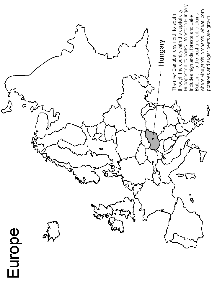
Hungary Map Coloring Pages are a great way to learn about Hungary’s adjacent countries. With framed country maps and labeled flags, this coloring page is perfect for introducing young learners to neighboring states; Bulgaria, Romania, Slovakia, Ukraine, and more! This coloring page also helps to practice visual discrimination and fine motor skills as children search for Hungary on the map and color it in. Plus, Hungary Map Coloring Pages are perfect for a homeschooling and classroom setting! Start exploring Hungary’s neighboring countries with the Coloring Pages today!
FUN FACTS!
Hungary is an exciting and diverse country located in the heart of Europe. Did you know Hungary has 8 neighboring countries? As a Hungary Map Countries enthusiast, I love learning about Hungary’s geographical position and its borders. Hungary has Slovakia to its north, Romania to its east, Serbia and Croatia to its south, and Slovenia to its southwest. What’s more interesting is Hungary also shares borders with Ukraine to the northeast and Austria to the west! These fun facts make it even more fascinating – Hungary is surrounded by beautiful lands offering plenty of places to explore. With so much history and culture at Hungary’s doorstep, it’s no wonder why Hungary Map Countries continues to capture people’s imaginations!
So what are you waiting for? Start exploring our coloring pages today! Want to see other country coloring pages?